Contents
Index
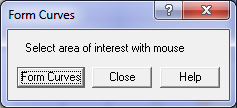
Form Curves
This is a tool for restructuring curve data which may have been derived from a GIS.
Most GIS systems cannot hold curve data which is defined in a parametric format (radius, arc length, centre point etc.)
Instead, each curve is defined as a series of very short chords.
These have to be turned back into a single "parametric" arc in the parcel boundary in order to correctly model the cadastral network.
Select the area of interest using the mouse to generate an expanding box.
The routine will scan through the data and generate arc records for sequences of short segments which have similar curve characteristics.
The original segments in each boundary will then be replaced by the parametric arc data computed from the segments.

